Monday’s models had suggested that the storm would continue into Eswatini and South Africa, impacting Mpumalanga, KwaZulu-Natal and Limpopo.
TROPICAL storm Eloise was has been upgraded from a moderate tropical storm to a severe tropical storm.
That was according to Météo-France which falls under the Regional Specialised Meteorological Centre (RSMC) or Tropical Cyclone Centre La Réunion which monitors tropical systems in the South-West Indian Ocean.
Data predicted that Eloise would reach Madagascar on Tuesday afternoon or evening.
The Meteo Madagascar said at 3pm (local time) Eloise was 39km east of Cap Est. Eloise had an average wind speed estimated at 100km/h with gusts of 140km/h around its centre.
It was moving south-west at 17km/h. It was expected to land on Masoala in the late afternoon.
Monday’s models had suggested that the storm would continue into Eswatini and South Africa, impacting Mpumalanga, KwaZulu-Natal and Limpopo.
According to Storm Report SA’s latest update, Eloise was expected to make landfall over the north-eastern parts of Madagascar on Tuesday.
After reaching landfall, the storm was expected to weaken, move over the island and then enter the Mozambique channel by Thursday, where it was expected to intensify again.
“The water in the channel is very warm and she is expected to intensify quickly reaching tropical cyclone strength just before making landfall over the southern parts of Mozambique by Saturday or Sunday,” said Storm Report SA.
The report said the European Centre for Medium-Range Weather Forecasts (ECMWF) weather model forecast that Eloise would move south along the Mozambique coastline while the Global Forecast System (GFS) model had indicated that it would make landfall over Mozambique and move west into South Africa, impacting Mpumalanga and Limpopo.
On Monday, the SA Weather Service said Eloise was positioned off the north-eastern quadrant of Madagascar. Then, the tropical storm was classified to be a moderate tropical storm but was set to intensify in the coming days.
It was predicted Eloise would on Tuesday move in a west-south-westerly direction. Eloise would move closer to the coast of Madagascar as it intensified into a severe tropical storm.
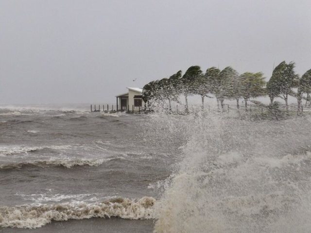
When Eloise made landfall it would likely cause considerable wind-related damage, as well as delivering torrential rain.
“Given the steep geographic terrain of eastern Madagascar, flooding and washaways are also a distinct possibility. Moreover, along the coast there will also be a risk of storm surge, especially on the southernmost leading quadrant of the storm system,” the weather service said.
Moreover, Eloise could gradually begin to move on a more southerly parabolic path (often termed a “polewards-accelerating” trajectory), which could potentially take it further down the Mozambican coastline and (possibly) into the north-eastern lowveld region of South Africa.
At the current time, the speculative possibility of Eloise directly affecting South Africa is only one of a multitude of possible outcomes, given the long lead-time, and should be considered to be a “low probability or high uncertainty” worst-case scenario.


